Walk Around Winchcombe, Cotswolds, England
/We did not walk into Winchcombe, as we did with Stow-on-the-Wold. Our driver delivered us to the Lion Inn where we checked in and received our walking instructions from a very helpful lady who was preparing the restaurant for lunch.
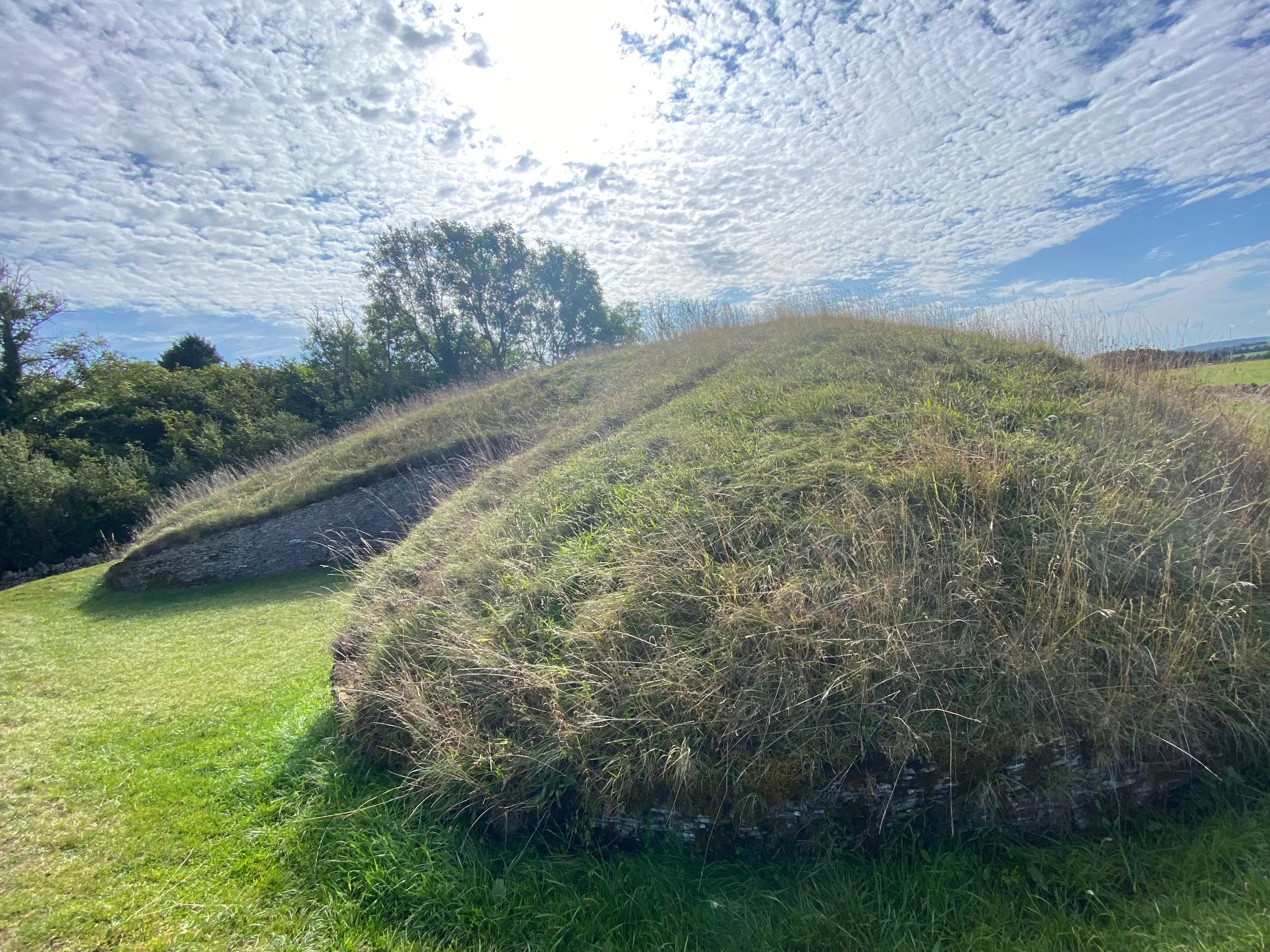
Belas Knap, is located on a hilltop about 2.5 miles south of Winchcombe. The English Heritage site is a Long Barrow, constructed around 5,000 years ago as a funeral site. The mound is 160 feet long, 54 feet wide and about 133 feet tall. The northern end has a false portal posing as an entrance which does not enter into the barrow. The south chamber, with east and west chambers located in about the center of the mound are entrances. The barrow was used as a burial chamber for several generations until all the entrances were completely blocked.
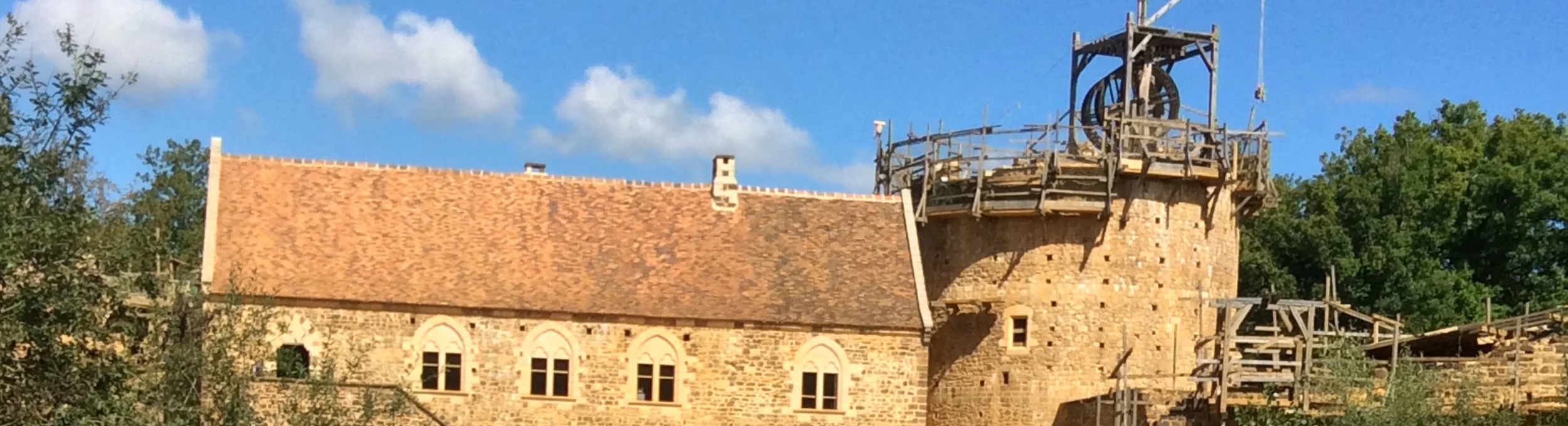
We had two choices, walk down the steep side street to a lane which would take us up to Sudley Castle, or go down the main street another block to another side street which would take us to the Sudley Castle entrance. We chose the shorter distance, even if it did involve a couple of steep hills. There is a slideshow dedicated to Sudley Castle, a privately owned estate famous as the last home of Catherine Parr, wife of Henry VIII.
On day 2 we started at St. Peter’s Church in Stanway, adjacent to the stupendous Stanway House, which we had seen the inside on a previous trip. Walking along the edge of the town we crossed through a series of pastures to the village of Stanton. We walked along High Street to the Church of St. Michael and All Angels. It was well worth the stop. Then we walked up to the Mount Inn at the top of a very steep hill just as the rain started. We ducked into a very crowded inn and found out they we were over extended and were no longer taking meal orders. So like many of the other travelers we settled for chips and a beer.
Our driver met us at the Mount Inn and took us on to Broadway and the northern station of the Gloucestershire and Warwickshire Railway. This is an abandoned railway which has been renovated by volunteers and operates daily, linking Broadway and the Cheltenham Racecourse with steam and diesel trains. Our steam locomotive broke down about half way through the trip, but after about a half hour they had the problem corrected and we were on our way. There is one stop in the center of the route in a town called Greet, on the edge of Winchcombe. We exited the train and walked about a mile to the Lion Inn. The walk to the inn gave us an opportunity to see the new developments on the outer edge of Winchcombe.
The next day was an exciting opportunity. Our driver dropped us off a couple miles outside of Winchcombe near an entrance into a forest. He said, “You can go into the forest and it’s short walk up the hill to see Belas Knap (Long Barrow) or you can follow the trail along the road until it drops down to an open field and you can cross into Sudeley Castle and then on to Winchcombe.”
Belas Knap is one of those wonders of the Cotswolds. It is barrow built on top of Cleeve Hill and is labeled a Cotswold Severn Cairn. The barrow is of stone construction and then covered with dirt and grass. Belas Knap was built about 3000 BCE and is 178 feet long, 60 feet wide and 14 feet tall, a huge undertaking by the builders 5,000 years ago. There are four burial chambers, which were sealed and hidden, and one false entrance. An excavation between 1863-65 found the skeletons of five children age 6 months to 8 years, and an excavation in 1963 found the skeletons of 38 people, along with animal bones, flint tools and pottery. The burials, the flint tools, and pottery located in the tombs are indications the burials took place over a long period of time
We started up the steep muddy path through the forest, which opened on to a pasture. Across the steep pasture we could see the top of a hill, and assumed that was the location of Belas Knap. As we followed the well-worn trail around the pasture and up the very steep hill we realized that there was not a mound on the top of the hill as we expected. The GPS app on the cell phone indicated we would cross a fence and skirt to the left. We met another walker who said to follow along the edge of the fence, and so we passed into the edge of another forest. About the time we had decided everything was wrong, we came to a well-marked entrance and there were the signs and panels with the barrow map, excavation information and timeline for the barrow.
And there were people. We were literally in the middle of nowhere, on the top of a hill, and there were a half dozen people wandering around the site when we arrived. When they left another dozen people arrived. That was when we learned that we were on the Cotswold Way, one of the most traveled walking trails in England.
Eventually we made our way back down to where the driver left us, and started our walk back to Winchcombe. We followed the paved road for about a quarter mile where our directions indicated to go left on a steep downhill trail. We passed a house and the trail split. Our map sent us off to the right and back up a hillside toward the highway, but an alternate route on the GPS showed a trail which continued down the hill, and we could see Winchcombe in the distance.
We followed that route on a narrow trail through the hay field and then down a very narrow, steep and muddy trail for a half mile or so until the terrain leveled and we passed a huge construction development. We walked out onto a gravel road and the trail ended. We waved at the gravel truck as it drove past us from the construction site toward town. We followed it to the main road leading us into Winchcombe.
Along the way we passed the formal entrance to Sudeley Castle. Now we knew where the lady at the Lion Inn had been telling us to go to on the other route a couple of days earlier.
And we were back into Winchcombe, tired, but a good day behind us.